
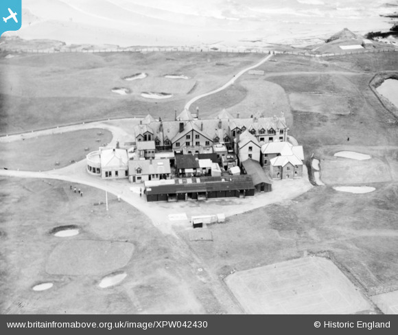
XPW042430 IRELAND (1933). Golf Course, Bundoran, Donegal, Ireland, 1933. Oblique aerial photograph taken facing South.
© Copyright OpenStreetMap contributors and licensed by the OpenStreetMap Foundation. 2026. Cartography is licensed as CC BY-SA.
Nearby Images (2)
XPW042430

XPW042431

Details
| Title | [XPW042430] Golf Course, Bundoran, Donegal, Ireland, 1933. Oblique aerial photograph taken facing South. |
| Reference | XPW042430 |
| Date | 1933 |
| Link | |
| Place name | BUNDORAN |
| Parish | IRELAND |
| District | |
| Country | IRELAND |
| Easting / Northing | -6244, 528219 |
| Longitude / Latitude | -8.276177, 54.486002 |
| National Grid Reference |
Pins
Be the first to add a comment to this image!