
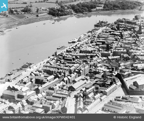
XPW042401 IRELAND (1933). General View, Waterford, Kilkenny, Ireland, 1933. Oblique aerial photograph taken facing East.
© Copyright OpenStreetMap contributors and licensed by the OpenStreetMap Foundation. 2026. Cartography is licensed as CC BY-SA.
Nearby Images (4)
XPW042401

XAW018980

XPW043432

XPW043433

Details
| Title | [XPW042401] General View, Waterford, Kilkenny, Ireland, 1933. Oblique aerial photograph taken facing East. |
| Reference | XPW042401 |
| Date | 1933 |
| Link | |
| Place name | WATERFORD |
| Parish | IRELAND |
| District | |
| Country | IRELAND |
| Easting / Northing | 51049, 274941 |
| Longitude / Latitude | -7.115823, 52.261602 |
| National Grid Reference |
Pins

ofarrl1960 |
Saturday 11th of November 2017 07:10:38 PM | |
|
ofarrl1960 |
Saturday 11th of November 2017 07:08:43 PM | |
|
ofarrl1960 |
Saturday 11th of November 2017 07:07:39 PM | |
|
ofarrl1960 |
Saturday 11th of November 2017 07:06:00 PM |