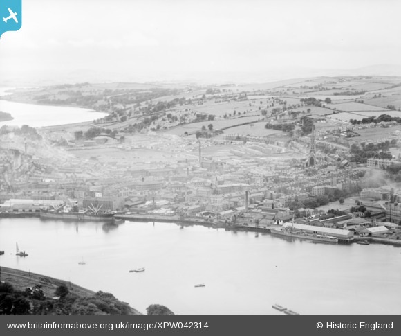
XPW042314 NORTHERN IRELAND (1933). General View, Londonderry, Derry, Northern Ireland, 1933. Oblique aerial photograph taken facing South/West.
© Copyright OpenStreetMap contributors and licensed by the OpenStreetMap Foundation. 2026. Cartography is licensed as CC BY-SA.
Details
| Title | [XPW042314] General View, Londonderry, Derry, Northern Ireland, 1933. Oblique aerial photograph taken facing South/West. |
| Reference | XPW042314 |
| Date | 1933 |
| Link | |
| Place name | LONDONDERRY |
| Parish | NORTHERN IRELAND |
| District | |
| Country | NORTHERN IRELAND |
| Easting / Northing | 59583, 580022 |
| Longitude / Latitude | -7.325344, 54.997974 |
| National Grid Reference |
Pins

SebastianG1 |
Thursday 3rd of March 2022 08:52:28 PM | |

Paul |
Sunday 17th of December 2017 10:35:45 AM |


![[XPW042314] General View, Londonderry, Derry, Northern Ireland, 1933. Oblique aerial photograph taken facing South/West.](http://britainfromabove.org.uk/sites/all/libraries/aerofilms-images/public/100x100/XPW/042/XPW042314.jpg)
![[XPW042315] General View, Londonderry, Derry, Northern Ireland, 1933. Oblique aerial photograph taken facing North/East.](http://britainfromabove.org.uk/sites/all/libraries/aerofilms-images/public/100x100/XPW/042/XPW042315.jpg)
![[XPW042316] General View, Londonderry, Derry, Northern Ireland, 1933. Oblique aerial photograph taken facing South/West.](http://britainfromabove.org.uk/sites/all/libraries/aerofilms-images/public/100x100/XPW/042/XPW042316.jpg)