
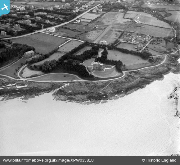
XPW033818 NORTHERN IRELAND (1930). "Thalesa", Bangor, North Down, Northern Ireland, 1930. Oblique aerial photograph taken facing South.
© Copyright OpenStreetMap contributors and licensed by the OpenStreetMap Foundation. 2025. Cartography is licensed as CC BY-SA.
Nearby Images (4)
XPW033818

XPW033819

XAW009830

XPW033873

Details
| Title | [XPW033818] "Thalesa", Bangor, North Down, Northern Ireland, 1930. Oblique aerial photograph taken facing South. |
| Reference | XPW033818 |
| Date | 1930 |
| Link | |
| Place name | BANGOR |
| Parish | NORTHERN IRELAND |
| District | |
| Country | NORTHERN IRELAND |
| Easting / Northing | 162353, 536412 |
| Longitude / Latitude | -5.686815, 54.666597 |
| National Grid Reference |
Pins
Be the first to add a comment to this image!