
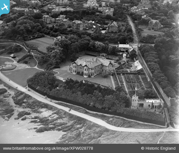
XPW028778 NORTHERN IRELAND (1929). "Glenbank", Bangor, North Down, Northern Ireland, 1929. Oblique aerial photograph taken facing South.
© Copyright OpenStreetMap contributors and licensed by the OpenStreetMap Foundation. 2026. Cartography is licensed as CC BY-SA.
Nearby Images (8)
XPW028778

XPW028776

XPW028775

XPW028777

XPW028885

XPW028882

XPW028779

XPW028884

Details
| Title | [XPW028778] "Glenbank", Bangor, North Down, Northern Ireland, 1929. Oblique aerial photograph taken facing South. |
| Reference | XPW028778 |
| Date | 1929 |
| Link | |
| Place name | BANGOR |
| Parish | NORTHERN IRELAND |
| District | |
| Country | NORTHERN IRELAND |
| Easting / Northing | 162836, 536517 |
| Longitude / Latitude | -5.679413, 54.667764 |
| National Grid Reference |
Pins
Be the first to add a comment to this image!