
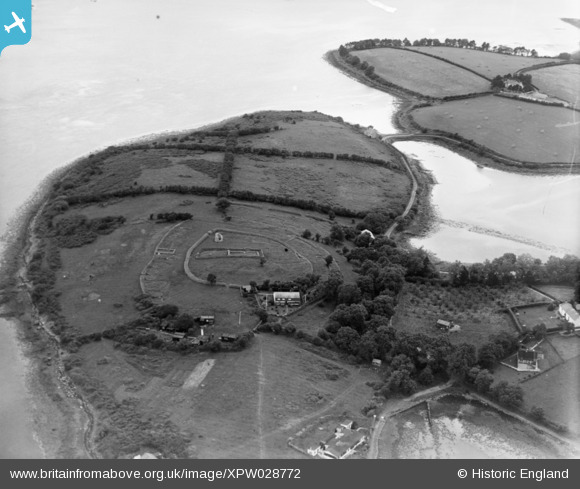
XPW028772 NORTHERN IRELAND (1929). Mahee Island, Whiterock, Ards, Northern Ireland, 1929. Oblique aerial photograph taken facing North.
© Copyright OpenStreetMap contributors and licensed by the OpenStreetMap Foundation. 2026. Cartography is licensed as CC BY-SA.
Nearby Images (3)
XPW028772

XPW028771

XPW028774

Details
| Title | [XPW028772] Mahee Island, Whiterock, Ards, Northern Ireland, 1929. Oblique aerial photograph taken facing North. |
| Reference | XPW028772 |
| Date | 1929 |
| Link | |
| Place name | WHITEROCK |
| Parish | NORTHERN IRELAND |
| District | |
| Country | NORTHERN IRELAND |
| Easting / Northing | 163906, 517609 |
| Longitude / Latitude | -5.647666, 54.498686 |
| National Grid Reference |
Pins
Be the first to add a comment to this image!