
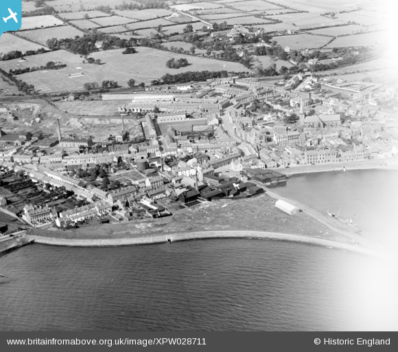
XPW028711 NORTHERN IRELAND (1929). General View, Carrickfergus, Carrickfergus, Northern Ireland, 1929. Oblique aerial photograph taken facing North.
© Copyright OpenStreetMap contributors and licensed by the OpenStreetMap Foundation. 2026. Cartography is licensed as CC BY-SA.
Nearby Images (5)
XPW028711

XPW028714

XPW015529

XPW028709

XAW019159

Details
| Title | [XPW028711] General View, Carrickfergus, Carrickfergus, Northern Ireland, 1929. Oblique aerial photograph taken facing North. |
| Reference | XPW028711 |
| Date | 1929 |
| Link | |
| Place name | CARRICKFERGUS |
| Parish | NORTHERN IRELAND |
| District | |
| Country | NORTHERN IRELAND |
| Easting / Northing | 154662, 542135 |
| Longitude / Latitude | -5.810601, 54.714223 |
| National Grid Reference |
Pins

manalive45 |
Tuesday 1st of December 2015 04:31:35 PM | |
|
ronnie |
Monday 16th of March 2015 05:25:08 PM | |
|
ronnie |
Monday 16th of March 2015 05:09:06 PM | |
Back Lane aka as Lancasterian Street. Named after Joseph Lancaster who introduced a revolutionary new type of school. He had a school in the lane. I have on good authority that the house connected with Carrick supply was formerly used as a school. |
ronnie |
Monday 16th of March 2015 05:15:12 PM |
|
ronnie |
Monday 16th of March 2015 05:05:36 PM | |
|
ronnie |
Monday 16th of March 2015 05:00:03 PM | |
|
ronnie |
Monday 16th of March 2015 04:58:22 PM | |
|
ronnie |
Monday 16th of March 2015 04:55:42 PM | |
|
ronnie |
Monday 16th of March 2015 04:53:27 PM | |
|
ronnie |
Monday 16th of March 2015 04:50:44 PM |
