
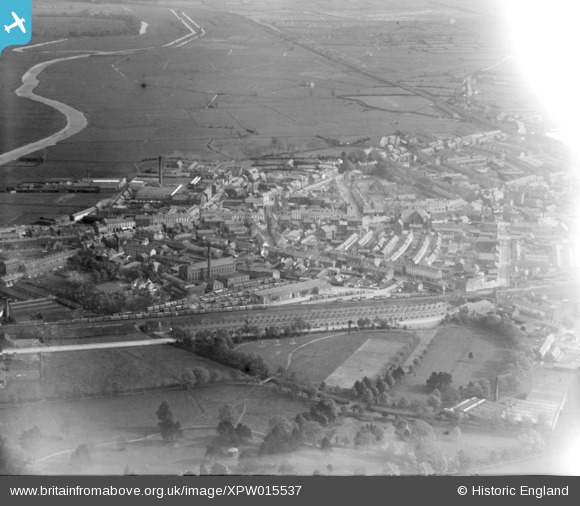
XPW015537 NORTHERN IRELAND (1926). General View, Portadown, Craigavon, Northern Ireland, 1926. Oblique aerial photograph taken facing South.
© Copyright OpenStreetMap contributors and licensed by the OpenStreetMap Foundation. 2026. Cartography is licensed as CC BY-SA.
Nearby Images (2)
XPW015537

XAW040563

Details
| Title | [XPW015537] General View, Portadown, Craigavon, Northern Ireland, 1926. Oblique aerial photograph taken facing South. |
| Reference | XPW015537 |
| Date | 3-May-1926 |
| Link | |
| Place name | PORTADOWN |
| Parish | NORTHERN IRELAND |
| District | |
| Country | NORTHERN IRELAND |
| Easting / Northing | 111888, 512230 |
| Longitude / Latitude | -6.443339, 54.423628 |
| National Grid Reference |
Pins
Be the first to add a comment to this image!