
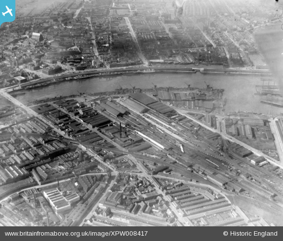
XPW008417 NORTHERN IRELAND (1923). Donegal Quay, Belfast, Belfast, Northern Ireland, 1923. Oblique aerial photograph taken facing North/West.
© Copyright OpenStreetMap contributors and licensed by the OpenStreetMap Foundation. 2026. Cartography is licensed as CC BY-SA.
Nearby Images (8)
XPW008417

XAW032809

XPW033857

XPW033863

XAW032811

XAW027626

XPW033856

XPW008415

Details
| Title | [XPW008417] Donegal Quay, Belfast, Belfast, Northern Ireland, 1923. Oblique aerial photograph taken facing North/West. |
| Reference | XPW008417 |
| Date | 1923 |
| Link | |
| Place name | BELFAST |
| Parish | NORTHERN IRELAND |
| District | |
| Country | NORTHERN IRELAND |
| Easting / Northing | 147208, 529979 |
| Longitude / Latitude | -5.915521, 54.601552 |
| National Grid Reference |
Pins

Michael |
Thursday 20th of October 2022 08:14:47 PM | |
|
Michael |
Thursday 20th of October 2022 08:14:26 PM | |
|
Denis |
Monday 13th of July 2015 02:00:35 PM | |
|
Buzby |
Sunday 14th of December 2014 11:40:56 AM | |
|
billh35 |
Monday 13th of October 2014 04:29:45 PM | |
|
billh35 |
Monday 13th of October 2014 04:29:03 PM | |
|
billh35 |
Monday 13th of October 2014 04:28:49 PM | |
|
billh35 |
Monday 13th of October 2014 04:26:29 PM | |
|
billh35 |
Monday 13th of October 2014 04:26:03 PM |