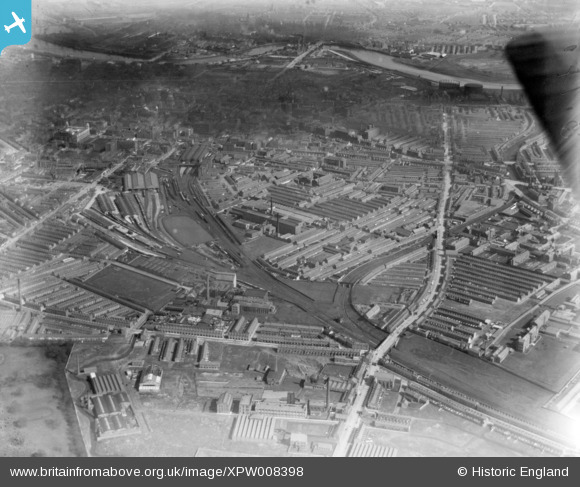
XPW008398 NORTHERN IRELAND (1923). Ulster Engineering Co, Belfast, Belfast, Northern Ireland, 1923. Oblique aerial photograph taken facing East.
© Copyright OpenStreetMap contributors and licensed by the OpenStreetMap Foundation. 2026. Cartography is licensed as CC BY-SA.
Details
| Title | [XPW008398] Ulster Engineering Co, Belfast, Belfast, Northern Ireland, 1923. Oblique aerial photograph taken facing East. |
| Reference | XPW008398 |
| Date | 1923 |
| Link | |
| Place name | BELFAST |
| Parish | NORTHERN IRELAND |
| District | |
| Country | NORTHERN IRELAND |
| Easting / Northing | 145242, 529087 |
| Longitude / Latitude | -5.945104, 54.592564 |
| National Grid Reference |
Pins

gBr |
Monday 5th of June 2017 12:34:05 PM | |

gBr |
Monday 5th of June 2017 12:32:02 PM | |

gBr |
Monday 5th of June 2017 12:31:00 PM | |

gBr |
Monday 5th of June 2017 12:29:34 PM | |

gBr |
Monday 5th of June 2017 12:27:34 PM | |

gBr |
Monday 5th of June 2017 12:26:00 PM | |

gBr |
Monday 5th of June 2017 12:24:33 PM | |

Buzby |
Sunday 14th of December 2014 11:10:51 AM |


![[XPW008398] Ulster Engineering Co, Belfast, Belfast, Northern Ireland, 1923. Oblique aerial photograph taken facing East.](http://britainfromabove.org.uk/sites/all/libraries/aerofilms-images/public/100x100/XPW/008/XPW008398.jpg)
![[XPW008397] Ulster Engineering Co, Belfast, Belfast, Northern Ireland, 1923. Oblique aerial photograph taken facing North/East.](http://britainfromabove.org.uk/sites/all/libraries/aerofilms-images/public/100x100/XPW/008/XPW008397.jpg)
![[XAW051686] Belfast Spec, Belfast, Belfast, Northern Ireland, 1953. Oblique aerial photograph taken facing North.](http://britainfromabove.org.uk/sites/all/libraries/aerofilms-images/public/100x100/XAW/051/XAW051686.jpg)