
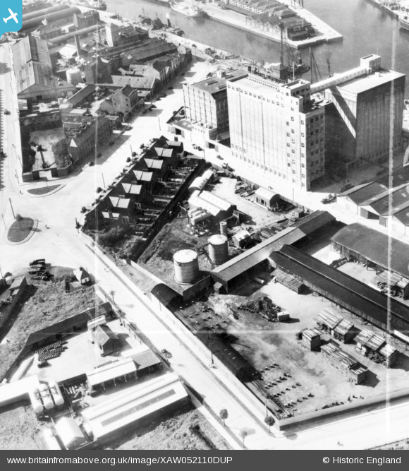
XAW052110DUP IRELAND (1953). Shell-Mex & BP Ltd., Cork, Eire, Cork, Cork, Ireland, 1953. Oblique aerial photograph taken facing West. This image was marked by Aerofilms Ltd for photo editing.
© Copyright OpenStreetMap contributors and licensed by the OpenStreetMap Foundation. 2026. Cartography is licensed as CC BY-SA.
Nearby Images (6)
XAW052110DUP

XAW052105

XAW052109DUP

XAW052112DUP

XAW052104DUP

XAW052111

Details
| Title | [XAW052110DUP] Shell-Mex & BP Ltd., Cork, Eire, Cork, Cork, Ireland, 1953. Oblique aerial photograph taken facing West. This image was marked by Aerofilms Ltd for photo editing. |
| Reference | XAW052110DUP |
| Date | 7-September-1953 |
| Link | |
| Place name | CORK |
| Parish | IRELAND |
| District | |
| Country | IRELAND |
| Easting / Northing | -43974, 241825 |
| Longitude / Latitude | -8.456896, 51.897429 |
| National Grid Reference |
Pins

powerpop |
Tuesday 12th of May 2015 04:39:35 PM | |
|
powerpop |
Sunday 19th of October 2014 03:25:04 PM | |
|
powerpop |
Sunday 19th of October 2014 03:24:45 PM | |
|
powerpop |
Sunday 19th of October 2014 03:24:04 PM | |
Albert Street station, closed 1932. |

gBr |
Monday 29th of December 2014 09:58:05 PM |
|
powerpop |
Sunday 19th of October 2014 03:23:21 PM |