
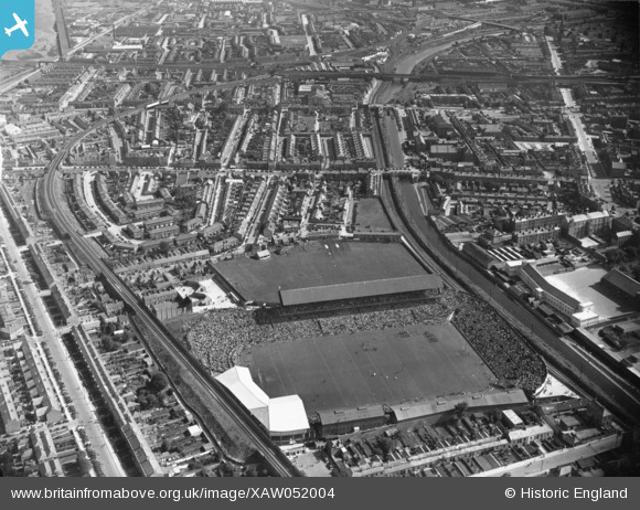
XAW052004 IRELAND (1953). Croke Park, Dublin, Dublin, Ireland, 1953. Oblique aerial photograph taken facing South/East.
© Copyright OpenStreetMap contributors and licensed by the OpenStreetMap Foundation. 2025. Cartography is licensed as CC BY-SA.
Nearby Images (3)
XAW052004

XAW052002

XAW052005

Details
| Title | [XAW052004] Croke Park, Dublin, Dublin, Ireland, 1953. Oblique aerial photograph taken facing South/East. |
| Reference | XAW052004 |
| Date | 6-September-1953 |
| Link | |
| Place name | DUBLIN |
| Parish | IRELAND |
| District | |
| Country | IRELAND |
| Easting / Northing | 117144, 393425 |
| Longitude / Latitude | -6.252852, 53.361801 |
| National Grid Reference |
