
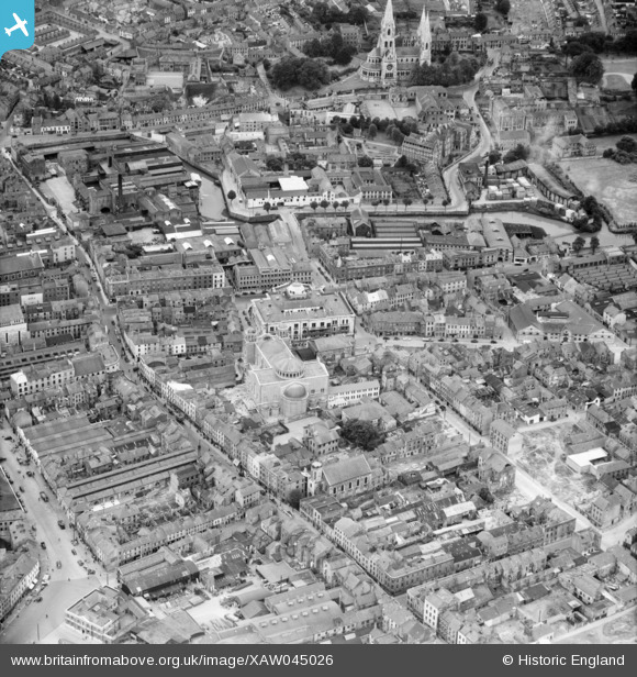
XAW045026 IRELAND (1952). General View, Cork, Cork, Ireland, 1952. Oblique aerial photograph taken facing South.
© Copyright OpenStreetMap contributors and licensed by the OpenStreetMap Foundation. 2026. Cartography is licensed as CC BY-SA.
Nearby Images (3)
XAW045026

XPW042451

XAW009613

Details
| Title | [XAW045026] General View, Cork, Cork, Ireland, 1952. Oblique aerial photograph taken facing South. |
| Reference | XAW045026 |
| Date | 1952 |
| Link | |
| Place name | CORK |
| Parish | IRELAND |
| District | |
| Country | IRELAND |
| Easting / Northing | -45525, 242104 |
| Longitude / Latitude | -8.479664, 51.89869 |
| National Grid Reference |
Pins

pocatech |
Monday 24th of January 2022 12:20:23 PM | |
|
pocatech |
Monday 24th of January 2022 12:20:02 PM | |
|
pocatech |
Monday 24th of January 2022 12:17:56 PM | |
|
pocatech |
Monday 24th of January 2022 12:16:22 PM | |

powerpop |
Tuesday 12th of May 2015 05:43:11 PM | |
|
powerpop |
Tuesday 12th of May 2015 05:42:30 PM | |
|
powerpop |
Monday 4th of May 2015 11:02:42 PM | |
|
powerpop |
Monday 4th of May 2015 11:00:53 PM | |
|
powerpop |
Monday 4th of May 2015 11:00:23 PM | |
|
powerpop |
Monday 4th of May 2015 10:59:26 PM | |
|
powerpop |
Monday 4th of May 2015 10:59:02 PM | |
|
powerpop |
Monday 4th of May 2015 10:58:06 PM | |
|
powerpop |
Monday 4th of May 2015 10:57:30 PM | |
|
powerpop |
Monday 4th of May 2015 10:57:09 PM | |
|
powerpop |
Monday 4th of May 2015 10:56:35 PM | |
|
powerpop |
Monday 4th of May 2015 10:55:52 PM |