
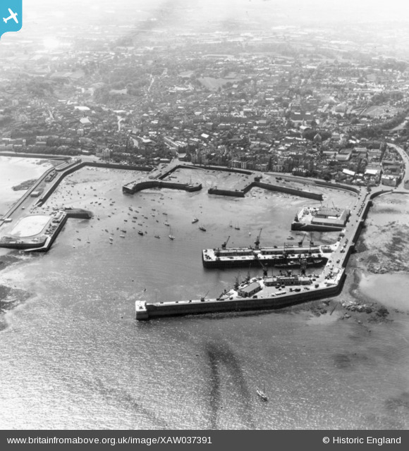
XAW037391 GUERNSEY (1951). Harbour, St Peter Port, Guernsey, Guernsey, 1951. Oblique aerial photograph taken facing West.
© Copyright OpenStreetMap contributors and licensed by the OpenStreetMap Foundation. 2026. Cartography is licensed as CC BY-SA.
Nearby Images (3)
XAW037391

XAW037392

XAW037351

Details
| Title | [XAW037391] Harbour, St Peter Port, Guernsey, Guernsey, 1951. Oblique aerial photograph taken facing West. |
| Reference | XAW037391 |
| Date | 22-June-1951 |
| Link | |
| Place name | ST PETER PORT |
| Parish | GUERNSEY |
| District | |
| Country | GUERNSEY |
| Easting / Northing | 361828, -49248 |
| Longitude / Latitude | -2.528006, 49.456085 |
| National Grid Reference |
Pins

CobhamJohn |
Friday 29th of March 2024 09:48:19 AM |