
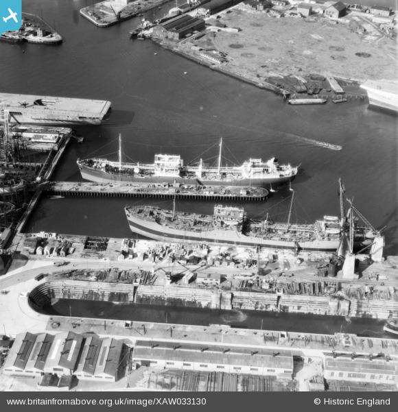
XAW033130 NORTHERN IRELAND (1950). General View, Belfast, Belfast, Northern Ireland, 1950. Oblique aerial photograph taken facing West.
© Copyright OpenStreetMap contributors and licensed by the OpenStreetMap Foundation. 2026. Cartography is licensed as CC BY-SA.
Nearby Images (12)
XAW033130

XAW033131

XPW043374

EAW018042

EAW018046

XAW009555

XPW042458

XAW033133

XPW043373

XPW043376

XPW043378

XAW009551

Details
| Title | [XAW033130] General View, Belfast, Belfast, Northern Ireland, 1950. Oblique aerial photograph taken facing West. |
| Reference | XAW033130 |
| Date | 15-September-1950 |
| Link | |
| Place name | BELFAST |
| Parish | NORTHERN IRELAND |
| District | |
| Country | NORTHERN IRELAND |
| Easting / Northing | 147992, 531231 |
| Longitude / Latitude | -5.904499, 54.613171 |
| National Grid Reference |
Pins

Vulcanicity |
Friday 2nd of May 2025 01:37:52 PM |