
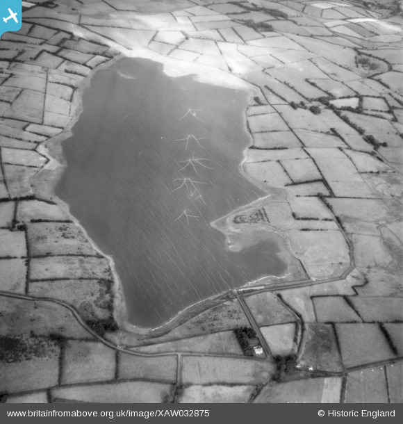
XAW032875 NORTHERN IRELAND (1950). Reservoir, Lough Mourne, Carrickfergus, Northern Ireland, 1950. Oblique aerial photograph taken facing North/West.
© Copyright OpenStreetMap contributors and licensed by the OpenStreetMap Foundation. 2026. Cartography is licensed as CC BY-SA.
Nearby Images (2)
XAW032875

XAW032876

Details
| Title | [XAW032875] Reservoir, Lough Mourne, Carrickfergus, Northern Ireland, 1950. Oblique aerial photograph taken facing North/West. |
| Reference | XAW032875 |
| Date | 20-September-1950 |
| Link | |
| Place name | LOUGH MOURNE |
| Parish | NORTHERN IRELAND |
| District | |
| Country | NORTHERN IRELAND |
| Easting / Northing | 155233, 547504 |
| Longitude / Latitude | -5.806273, 54.762646 |
| National Grid Reference |
Pins
Be the first to add a comment to this image!
User Comment Contributions

1950 |

Valerie |
Monday 13th of October 2014 11:10:06 PM |