
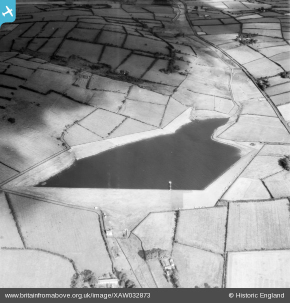
XAW032873 NORTHERN IRELAND (1950). Reservoir, Ballycarry, Carrickfergus, Northern Ireland, 1950. Oblique aerial photograph taken facing North.
© Copyright OpenStreetMap contributors and licensed by the OpenStreetMap Foundation. 2026. Cartography is licensed as CC BY-SA.
Nearby Images (2)
XAW032873

XAW032874

Details
| Title | [XAW032873] Reservoir, Ballycarry, Carrickfergus, Northern Ireland, 1950. Oblique aerial photograph taken facing North. |
| Reference | XAW032873 |
| Date | 20-September-1950 |
| Link | |
| Place name | BALLYCARRY |
| Parish | NORTHERN IRELAND |
| District | |
| Country | NORTHERN IRELAND |
| Easting / Northing | 156631, 546162 |
| Longitude / Latitude | -5.783473, 54.75129 |
| National Grid Reference |
Pins
Be the first to add a comment to this image!
User Comment Contributions

1950 |

Valerie |
Monday 13th of October 2014 11:09:10 PM |