
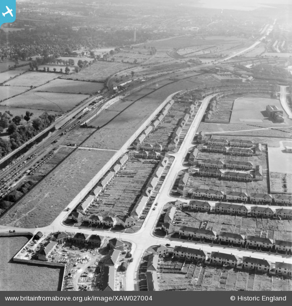
XAW027004 IRELAND (1949). Bannon Road, Dublin, Dublin, Ireland, 1949. Oblique aerial photograph taken facing East.
© Copyright OpenStreetMap contributors and licensed by the OpenStreetMap Foundation. 2026. Cartography is licensed as CC BY-SA.
Nearby Images (4)
XAW027004

XAW027003

XAW027006

XAW027005

Details
| Title | [XAW027004] Bannon Road, Dublin, Dublin, Ireland, 1949. Oblique aerial photograph taken facing East. |
| Reference | XAW027004 |
| Date | 30-September-1949 |
| Link | |
| Place name | DUBLIN |
| Parish | IRELAND |
| District | |
| Country | IRELAND |
| Easting / Northing | 114293, 394560 |
| Longitude / Latitude | -6.296592, 53.370448 |
| National Grid Reference |
Pins
Be the first to add a comment to this image!