
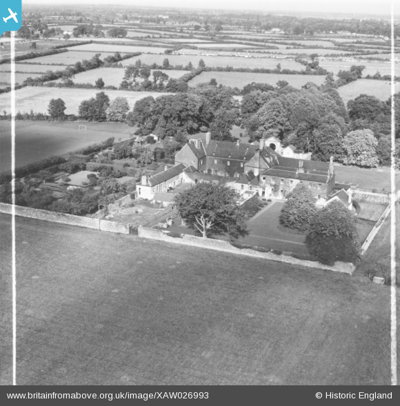
XAW026993 IRELAND (1949). The Colleigate School, Celbridge, Kildare, Ireland, 1949. Oblique aerial photograph taken facing North. This image was marked by Aerofilms Ltd for photo editing.
© Copyright OpenStreetMap contributors and licensed by the OpenStreetMap Foundation. 2026. Cartography is licensed as CC BY-SA.
Nearby Images (5)
XAW026993

XAW026992

XAW026990

XAW026989

XAW026991

Details
| Title | [XAW026993] The Colleigate School, Celbridge, Kildare, Ireland, 1949. Oblique aerial photograph taken facing North. This image was marked by Aerofilms Ltd for photo editing. |
| Reference | XAW026993 |
| Date | 30-September-1949 |
| Link | |
| Place name | CELBRIDGE |
| Parish | IRELAND |
| District | |
| Country | IRELAND |
| Easting / Northing | 96639, 391643 |
| Longitude / Latitude | -6.558301, 53.334476 |
| National Grid Reference |
Pins
Be the first to add a comment to this image!