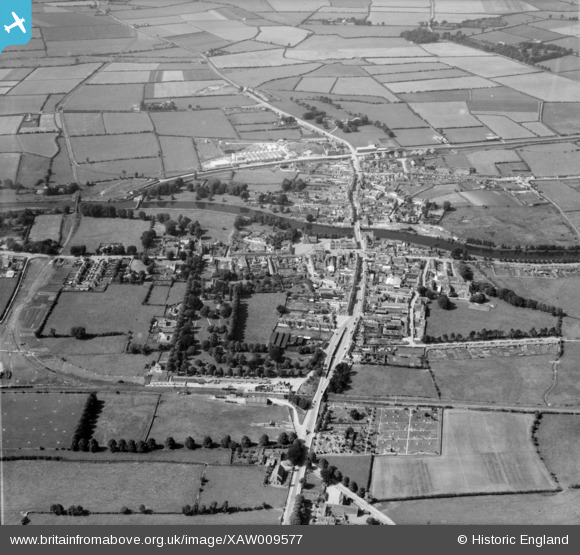
XAW009577 IRELAND (1947). General View, Athy, Kildare, Ireland, 1947. Oblique aerial photograph taken facing West.
    © Copyright OpenStreetMap contributors and licensed by the OpenStreetMap Foundation. 2025. Cartography is licensed as CC BY-SA.
  
Details
| Title | [XAW009577] General View, Athy, Kildare, Ireland, 1947. Oblique aerial photograph taken facing West. | 
| Reference | XAW009577 | 
| Date | 15-August-1947 | 
| Link | |
| Place name | ATHY | 
| Parish | IRELAND | 
| District | |
| Country | IRELAND | 
| Easting / Northing | 65648, 355283 | 
| Longitude / Latitude | -6.98401, 52.990225 | 
| National Grid Reference | 
 
             
  ![[XAW009577] General View, Athy, Kildare, Ireland, 1947. Oblique aerial photograph taken facing West.](http://britainfromabove.org.uk/sites/all/libraries/aerofilms-images/public/100x100/XAW/009/XAW009577.jpg) 
  
                                          ![[XAW009576] General View, Athy, Kildare, Ireland, 1947. Oblique aerial photograph taken facing North/West.](http://britainfromabove.org.uk/sites/all/libraries/aerofilms-images/public/100x100/XAW/009/XAW009576.jpg) 
 ![[XAW009586] White Castle , Athy, Kildare, Ireland, 1947. Oblique aerial photograph taken facing South.](http://britainfromabove.org.uk/sites/all/libraries/aerofilms-images/public/100x100/XAW/009/XAW009586.jpg) 
  Spur railway line, originally to Wolfhill Colliery and subsequently to the Tegral factory on the far side of The Barrow River.
 Spur railway line, originally to Wolfhill Colliery and subsequently to the Tegral factory on the far side of The Barrow River.