
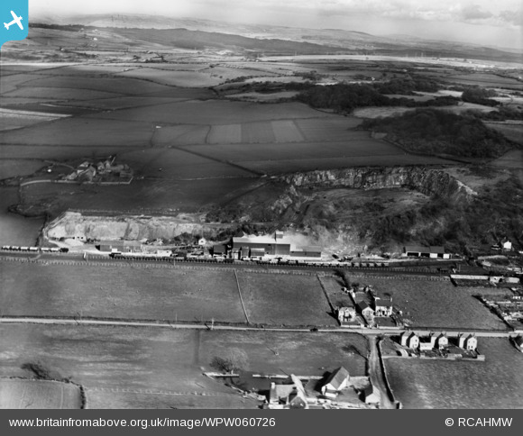
WPW060726 WALES (1939). View of C.F. Gaen, Cornelly Quarries, Pyle, oblique aerial view. 5"x4" black and white glass plate negative.
© Copyright OpenStreetMap contributors and licensed by the OpenStreetMap Foundation. 2026. Cartography is licensed as CC BY-SA.
Nearby Images (7)
WPW060726

WPW060727

WPW060728

WPW060729

WPW060730

WPW060731

WPW060732

Details
| Title | [WPW060726] View of C.F. Gaen, Cornelly Quarries, Pyle, oblique aerial view. 5"x4" black and white glass plate negative. |
| Reference | WPW060726 |
| Date | 1939 |
| Link | Coflein Archive Item 6370486 |
| Place name | |
| Parish | |
| District | |
| Country | WALES |
| Easting / Northing | 282161, 180552 |
| Longitude / Latitude | -3.6982883339402, 51.511108778223 |
| National Grid Reference | SS822806 |
Pins

Harvey |
Monday 30th of March 2015 10:19:54 PM | |
|
Harvey |
Monday 30th of March 2015 10:04:41 PM | |
|
Harvey |
Monday 30th of March 2015 10:02:48 PM | |
|
Harvey |
Monday 30th of March 2015 10:01:15 PM | |
|
Harvey |
Monday 30th of March 2015 09:45:42 PM |