
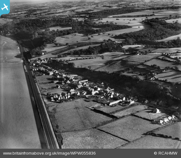
WPW055836 WALES (1937). View of Ffynongroew, oblique aerial view. 5"x4" black and white glass plate negative.
© Copyright OpenStreetMap contributors and licensed by the OpenStreetMap Foundation. 2025. Cartography is licensed as CC BY-SA.
Nearby Images (8)
WAW028164

WAW028205

WAW028206

WAW028232

WAW028233

WAW028234

WAW028235

WPW055836

Details
| Title | [WPW055836] View of Ffynongroew, oblique aerial view. 5"x4" black and white glass plate negative. |
| Reference | WPW055836 |
| Date | 30-October-1937 |
| Link | Coflein Archive Item 6370420 |
| Place name | |
| Parish | |
| District | |
| Country | WALES |
| Easting / Northing | 313668, 382216 |
| Longitude / Latitude | -3.2964663394445, 53.32953782225 |
| National Grid Reference | SJ137822 |
Pins
Be the first to add a comment to this image!
User Comment Contributions
That last row of terraces next to the railway, was the home of my nan and grand dad, Davies Terrace all gone now with the upgrade of the new coast road. |

redcap480 |
Wednesday 10th of June 2015 10:15:04 AM |
That last row of terraces next to the railway, was the home of my nan and grand dad, Davies Terrace all gone now with the upgrade of the new coast road. |
redcap480 |
Wednesday 10th of June 2015 10:15:01 AM |