
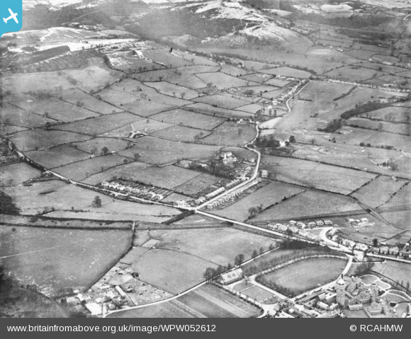
WPW052612 WALES (1937). View of the Whitchurch area of Cardiff showing Whitchurch Hospital and distant view of Forest Fawr. Oblique aerial photograph, 5"x4" BW glass plate.
© Copyright OpenStreetMap contributors and licensed by the OpenStreetMap Foundation. 2026. Cartography is licensed as CC BY-SA.
Nearby Images (5)
WPW016938

WPW016939

WPW032468

WPW032469

WPW052612

Details
| Title | [WPW052612] View of the Whitchurch area of Cardiff showing Whitchurch Hospital and distant view of Forest Fawr. Oblique aerial photograph, 5"x4" BW glass plate. |
| Reference | WPW052612 |
| Date | 1937 |
| Link | Coflein Archive Item 6422540 |
| Place name | |
| Parish | |
| District | |
| Country | WALES |
| Easting / Northing | 314617, 180497 |
| Longitude / Latitude | -3.2306592852649, 51.516453059776 |
| National Grid Reference | ST146805 |
Pins

Curly-col |
Sunday 16th of April 2023 01:16:09 AM | |
|
IanGardiner |
Sunday 14th of February 2021 10:13:45 PM | |
|
DMJT |
Tuesday 28th of June 2016 11:47:38 PM | |
|
williamsrhiwbina |
Thursday 9th of October 2014 10:55:32 PM | |
|
williamsrhiwbina |
Thursday 9th of October 2014 10:50:00 PM | |
|
williamsrhiwbina |
Thursday 9th of October 2014 10:49:04 PM | |
|
williamsrhiwbina |
Thursday 9th of October 2014 10:46:07 PM |