
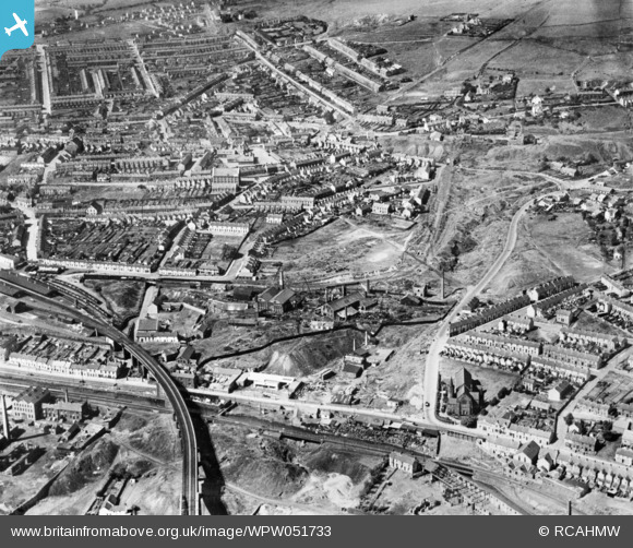
WPW051733 WALES (1936). View of the Landore district of Swansea showing the Millbrook Engineering Co. works. Oblique aerial photograph, 5"x4" BW glass plate.
© Copyright OpenStreetMap contributors and licensed by the OpenStreetMap Foundation. 2026. Cartography is licensed as CC BY-SA.
Nearby Images (2)
WPW051733

WPW051735

Details
| Title | [WPW051733] View of the Landore district of Swansea showing the Millbrook Engineering Co. works. Oblique aerial photograph, 5"x4" BW glass plate. |
| Reference | WPW051733 |
| Date | 1936 |
| Link | Coflein Archive Item 6423093 |
| Place name | |
| Parish | |
| District | |
| Country | WALES |
| Easting / Northing | 265963, 195842 |
| Longitude / Latitude | -3.9374346966883, 51.644913120086 |
| National Grid Reference | SS660958 |
Pins

Paul Reynolds |
Friday 19th of December 2025 12:49:10 PM | |
|
Harvey |
Wednesday 26th of August 2015 08:21:46 PM | |
|
Harvey |
Wednesday 26th of August 2015 08:20:17 PM | |
|
Harvey |
Wednesday 26th of August 2015 08:19:32 PM | |
|
Harvey |
Wednesday 26th of August 2015 08:18:45 PM |