
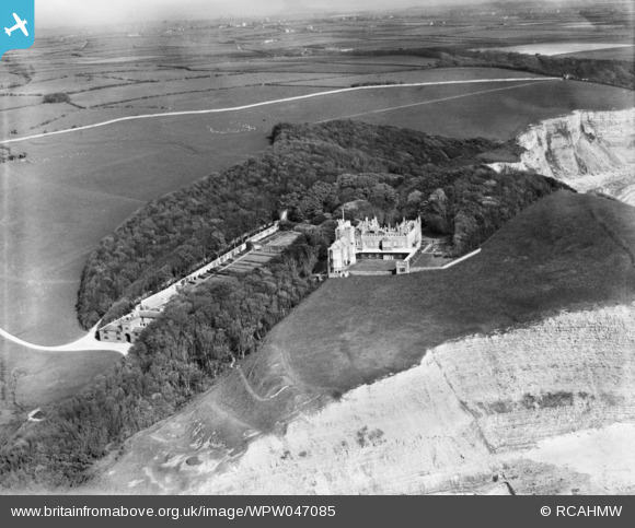
WPW047085 WALES (1935). View of Dunraven Castle, oblique aerial view. 5"x4" black and white glass plate negative.
© Copyright OpenStreetMap contributors and licensed by the OpenStreetMap Foundation. 2026. Cartography is licensed as CC BY-SA.
Nearby Images (10)
WAW005923

WAW005924

WAW005925

WAW005926

WAW005927

WAW014937

WAW014938

WPW029797

WPW029798

WPW047085

Details
| Title | [WPW047085] View of Dunraven Castle, oblique aerial view. 5"x4" black and white glass plate negative. |
| Reference | WPW047085 |
| Date | 1935 |
| Link | Coflein Archive Item 6369980 |
| Place name | |
| Parish | |
| District | |
| Country | WALES |
| Easting / Northing | 288780, 172810 |
| Longitude / Latitude | -3.6004989229207, 51.442857745952 |
| National Grid Reference | SS888728 |
Pins
Be the first to add a comment to this image!
User Comment Contributions
Dunraven Castle was demolished in 1963 |

GMS |
Tuesday 26th of June 2012 05:06:35 PM |