
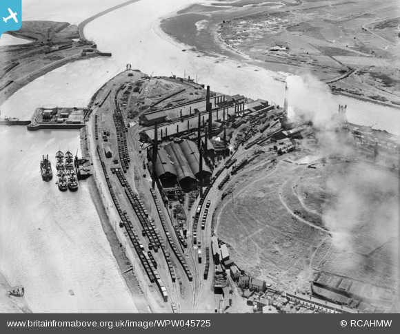
WPW045725 WALES (1934). View of Neath River Navigation at Briton Ferry showing Briton Ferry dock, Cambria Cokeworks, Gwalia and Victoria tinplate works and Britain Ferry steelworks, oblique aerial view. 5"x4" black and white glass plate negative.
© Copyright OpenStreetMap contributors and licensed by the OpenStreetMap Foundation. 2026. Cartography is licensed as CC BY-SA.
Nearby Images (2)
WPW045725

WPW045726

Details
| Title | [WPW045725] View of Neath River Navigation at Briton Ferry showing Briton Ferry dock, Cambria Cokeworks, Gwalia and Victoria tinplate works and Britain Ferry steelworks, oblique aerial view. 5"x4" black and white glass plate negative. |
| Reference | WPW045725 |
| Date | 1934 |
| Link | Coflein Archive Item 6369923 |
| Place name | |
| Parish | |
| District | |
| Country | WALES |
| Easting / Northing | 272000, 192500 |
| Longitude / Latitude | -3.8490011718479, 51.616283367559 |
| National Grid Reference | SS720925 |
Pins

sloyne |
Sunday 28th of July 2013 11:29:55 PM | |

Class31 |
Thursday 11th of October 2012 11:11:17 PM | |
|
MB |
Sunday 16th of September 2012 10:28:52 PM | |
|
MB |
Sunday 16th of September 2012 10:27:19 PM | |
|
MB |
Sunday 16th of September 2012 10:24:56 PM |
User Comment Contributions
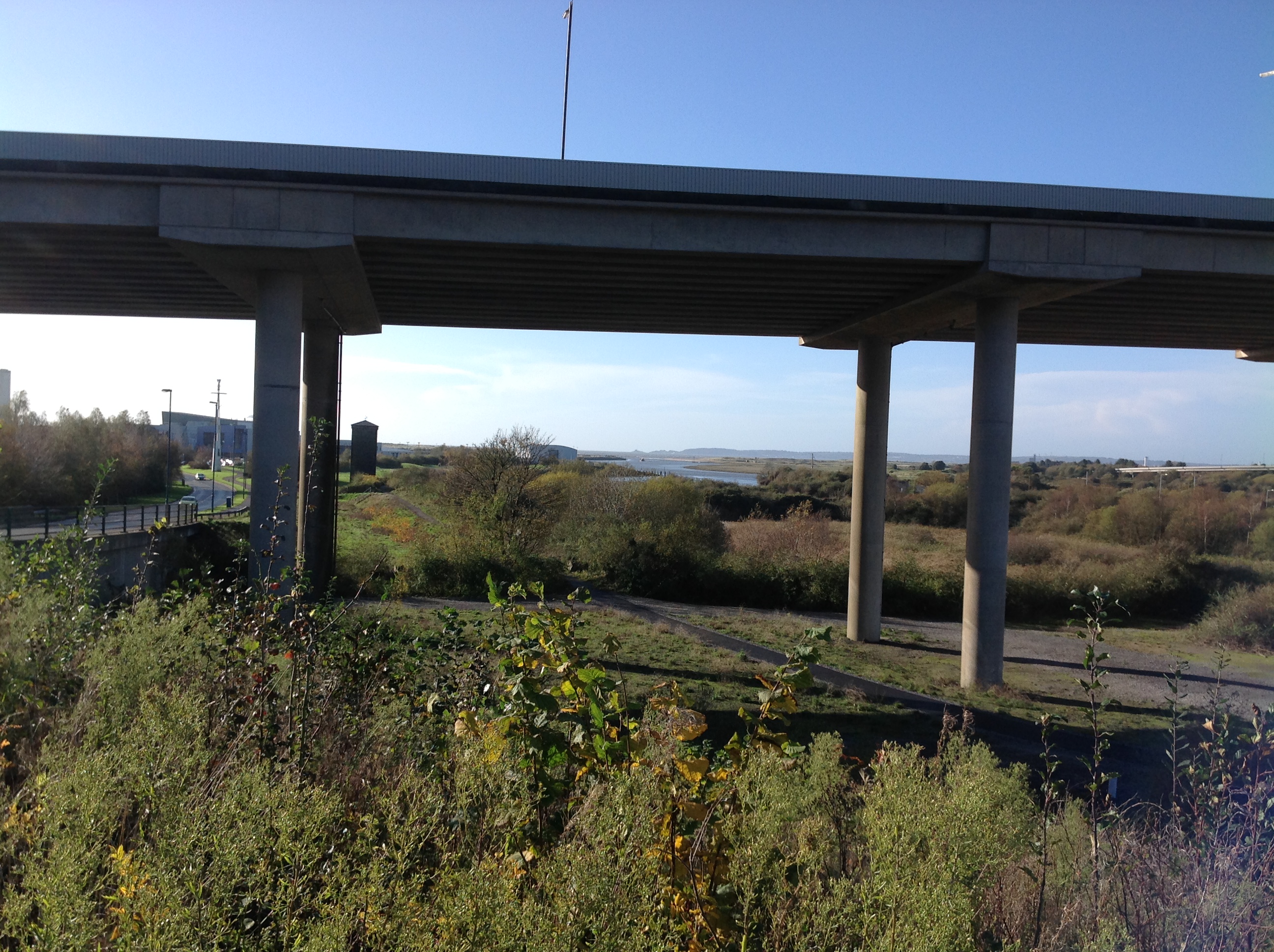
View south west from Briton Ferry towards the mouth of the River Neath showing M4 viaduct, 14/11/2014 |
Class31 |
Monday 17th of November 2014 01:23:29 PM |
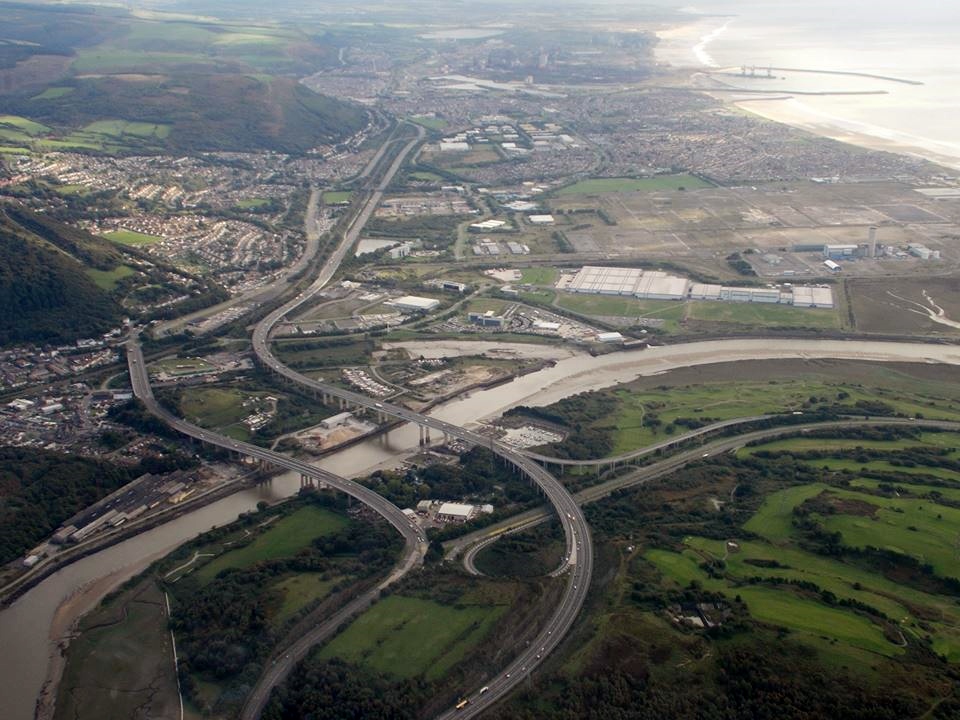
Aerial view of the River Neath road crossings taken 9th October 2013 courtesy Mr Conway Shields. Shows the site of the Baglan Bay Tinplate Co. |
Class31 |
Sunday 3rd of November 2013 02:27:48 PM |
Typo in heading - Tinplate not Timplate. |
MB |
Sunday 16th of September 2012 10:25:52 PM |