
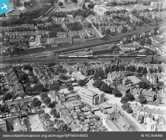
WPW044803 WALES (1934). View of central Cardiff, showing Heathfield House catholic school, Mansion House and the Prince of Wales hospital, oblique aerial view. 5"x4" black and white glass plate negative.
© Copyright OpenStreetMap contributors and licensed by the OpenStreetMap Foundation. 2026. Cartography is licensed as CC BY-SA.
Nearby Images (6)
WPW044798

WPW044799

WPW044800

WPW044801

WPW044802

WPW044803

Details
| Title | [WPW044803] View of central Cardiff, showing Heathfield House catholic school, Mansion House and the Prince of Wales hospital, oblique aerial view. 5"x4" black and white glass plate negative. |
| Reference | WPW044803 |
| Date | 1934 |
| Link | Coflein Archive Item 6369801 |
| Place name | |
| Parish | |
| District | |
| Country | WALES |
| Easting / Northing | 318869, 176983 |
| Longitude / Latitude | -3.1685792065601, 51.485486815915 |
| National Grid Reference | ST189770 |
Pins

niecieden |
Tuesday 18th of April 2017 10:23:48 PM | |
|
niecieden |
Tuesday 18th of April 2017 09:36:18 PM | |
|
niecieden |
Friday 14th of April 2017 11:28:59 PM | |
|
niecieden |
Friday 14th of April 2017 11:23:43 PM | |
|
niecieden |
Friday 14th of April 2017 03:21:55 PM | |

Class31 |
Monday 28th of July 2014 01:57:25 PM | |
|
Chelsea61 |
Saturday 30th of June 2012 01:19:19 PM |
