
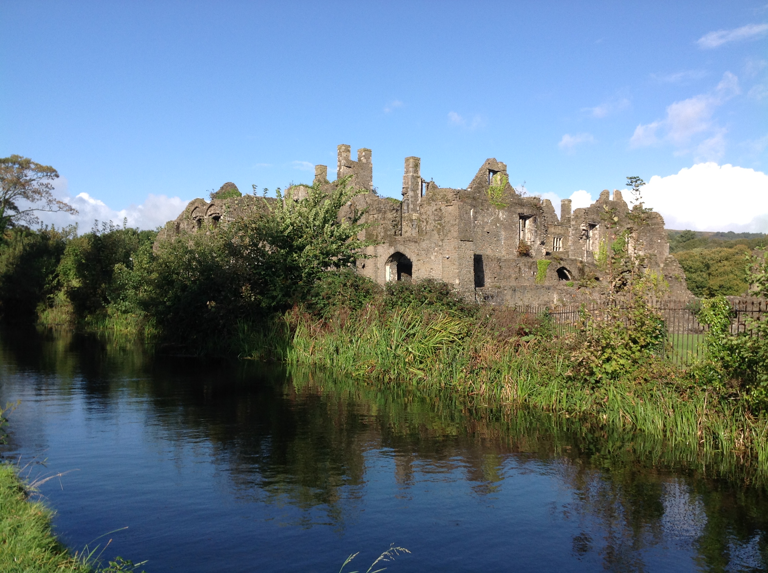
WPW043064 WALES (1933). Neath Abbey (ruins), oblique aerial view.

© Copyright OpenStreetMap contributors and licensed by the OpenStreetMap Foundation. 2026. Cartography is licensed as CC BY-SA.
Nearby Images (2)
WPW043064
, oblique aerial view.")
WPW043065
, oblique aerial view.")
Details
| Title | [WPW043064] Neath Abbey (ruins), oblique aerial view. |
| Reference | WPW043064 |
| Date | September-1933 |
| Link | Coflein Archive Item 6335324 |
| Place name | |
| Parish | |
| District | |
| Country | WALES |
| Easting / Northing | 273780, 197360 |
| Longitude / Latitude | -3.8250557235449, 51.660365769756 |
| National Grid Reference | SS738974 |
Pins

Andrew |
Sunday 16th of July 2017 07:37:19 PM | |

Class31 |
Thursday 20th of June 2013 02:32:14 PM | |
|
Dai |
Wednesday 27th of June 2012 07:18:09 AM | |
|
Dai |
Wednesday 27th of June 2012 07:17:25 AM | |
|
Green |
Tuesday 26th of June 2012 04:27:14 PM |

User Comment Contributions
Neath Abbey, 10/10/2014 |
Class31 |
Monday 13th of October 2014 01:27:50 PM |
Neath Abbey, 10/10/2014 |
Class31 |
Monday 13th of October 2014 01:26:53 PM |

Neath Abbey, 10/10/2014 |
Class31 |
Monday 13th of October 2014 01:26:21 PM |

This was Neath Abbey as it was in 1933 during the excavations carried out by the Neath Antiquarian Society. |
Dwr-y-Felin |
Monday 29th of September 2014 12:59:53 PM |

Tennant Canal at Neath Abbey, 12/08/2012 |
Class31 |
Sunday 21st of September 2014 08:32:51 PM |

Looking north. |
Class31 |
Monday 15th of July 2013 09:26:41 AM |

View looking east. |
Class31 |
Sunday 14th of July 2013 11:41:10 PM |

View looking east. |
Class31 |
Sunday 14th of July 2013 11:39:47 PM |

A view east along the Tennant Canal taken yesterday. |
Class31 |
Sunday 14th of July 2013 11:38:04 PM |