
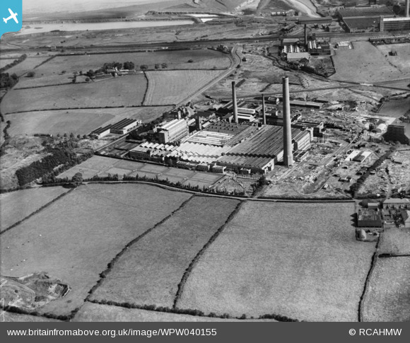
WPW040155 WALES (1932). View of Castle works Courtalds Limited, oblique aerial view. 5"x4" black and white glass plate negative.
© Copyright OpenStreetMap contributors and licensed by the OpenStreetMap Foundation. 2026. Cartography is licensed as CC BY-SA.
Nearby Images (12)
WAW039245

WAW039246

WAW039247

WAW039248

WAW039249

WAW039250

WAW039251

WAW039252

WAW039253

WPW040153

WPW040155

WPW040157

Details
| Title | [WPW040155] View of Castle works Courtalds Limited, oblique aerial view. 5"x4" black and white glass plate negative. |
| Reference | WPW040155 |
| Date | 1932 |
| Link | Coflein Archive Item 6369726 |
| Place name | |
| Parish | |
| District | |
| Country | WALES |
| Easting / Northing | 324377, 373423 |
| Longitude / Latitude | -3.1335897256078, 53.252145029257 |
| National Grid Reference | SJ244734 |
Pins

beast66606 |
Tuesday 13th of May 2014 03:06:46 PM | |
|
martin pearson |
Monday 19th of August 2013 04:03:19 PM | |
|
martin pearson |
Monday 19th of August 2013 04:00:26 PM | |
|
martin pearson |
Monday 19th of August 2013 03:59:15 PM | |
|
luca |
Monday 5th of November 2012 09:29:10 PM | |
|
JP |
Saturday 6th of October 2012 04:00:00 PM | |
|
JP |
Saturday 6th of October 2012 03:59:12 PM |
