
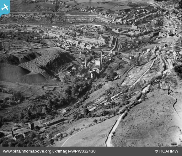
WPW032430 WALES (1930). View of Maritime Colliery and coke works, Pontypridd, oblique aerial view. 5"x4" black and white glass plate negative.
© Copyright OpenStreetMap contributors and licensed by the OpenStreetMap Foundation. 2026. Cartography is licensed as CC BY-SA.
Nearby Images (4)
WPW032418

WPW032419

WPW032430

WPW032431

Details
| Title | [WPW032430] View of Maritime Colliery and coke works, Pontypridd, oblique aerial view. 5"x4" black and white glass plate negative. |
| Reference | WPW032430 |
| Date | 1930 |
| Link | Coflein Archive Item 6370747 |
| Place name | |
| Parish | |
| District | |
| Country | WALES |
| Easting / Northing | 306550, 189350 |
| Longitude / Latitude | -3.3492522226376, 51.594763744407 |
| National Grid Reference | ST066894 |
Pins

massyboy |
Thursday 13th of November 2014 10:11:07 PM | |
|
Stockholm |
Sunday 13th of January 2013 04:28:51 PM | |
|
Stockholm |
Sunday 13th of January 2013 04:26:18 PM | |
|
Stockholm |
Sunday 13th of January 2013 04:24:59 PM | |
|
Stockholm |
Sunday 13th of January 2013 04:23:03 PM |