
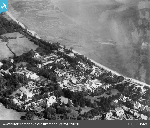
WPW029828 WALES (1929). View of Mumbles showing railway. Oblique aerial photograph, 5"x4" BW glass plate.
© Copyright OpenStreetMap contributors and licensed by the OpenStreetMap Foundation. 2026. Cartography is licensed as CC BY-SA.
Nearby Images (3)
WPW029828

WPW029833

WPW029838

Details
| Title | [WPW029828] View of Mumbles showing railway. Oblique aerial photograph, 5"x4" BW glass plate. |
| Reference | WPW029828 |
| Date | 1929 |
| Link | Coflein Archive Item 6422671 |
| Place name | |
| Parish | |
| District | |
| Country | WALES |
| Easting / Northing | 261000, 188000 |
| Longitude / Latitude | -4.006015898297, 51.573233456836 |
| National Grid Reference | SS610880 |
Pins
Be the first to add a comment to this image!