
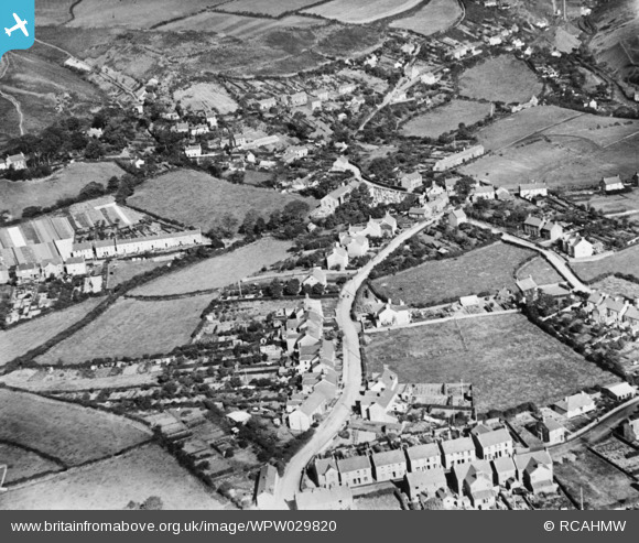
WPW029820 WALES (1929). View of Achddu area of Burry Port showing Jerwsalem chapel. Oblique aerial photograph, 5"x4" BW glass plate.
© Copyright OpenStreetMap contributors and licensed by the OpenStreetMap Foundation. 2026. Cartography is licensed as CC BY-SA.
Nearby Images (4)
WPW029815

WPW029820

WPW029823

WPW029824

Details
| Title | [WPW029820] View of Achddu area of Burry Port showing Jerwsalem chapel. Oblique aerial photograph, 5"x4" BW glass plate. |
| Reference | WPW029820 |
| Date | September-1929 |
| Link | Coflein Archive Item 6422480 |
| Place name | |
| Parish | |
| District | |
| Country | WALES |
| Easting / Northing | 244639, 200928 |
| Longitude / Latitude | -4.2476856298942, 51.685125191168 |
| National Grid Reference | SN446009 |
Pins
Be the first to add a comment to this image!