
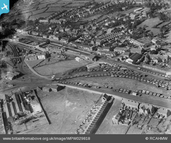
WPW029818 WALES (1929). View of Pembrey, oblique aerial view. 5"x4" black and white glass plate negative.
© Copyright OpenStreetMap contributors and licensed by the OpenStreetMap Foundation. 2026. Cartography is licensed as CC BY-SA.
Nearby Images (3)
WPW029816

WPW029817

WPW029818

Details
| Title | [WPW029818] View of Pembrey, oblique aerial view. 5"x4" black and white glass plate negative. |
| Reference | WPW029818 |
| Date | 1929 |
| Link | Coflein Archive Item 6370662 |
| Place name | |
| Parish | |
| District | |
| Country | WALES |
| Easting / Northing | 242616, 201362 |
| Longitude / Latitude | -4.2771243767742, 51.688461307437 |
| National Grid Reference | SN426014 |
Pins

Treforys |
Tuesday 7th of August 2012 12:51:21 AM | |
|
Treforys |
Tuesday 7th of August 2012 12:50:07 AM | |
|
Treforys |
Tuesday 7th of August 2012 12:48:16 AM | |
|
Treforys |
Tuesday 7th of August 2012 12:45:37 AM | |
|
Treforys |
Tuesday 7th of August 2012 12:43:38 AM | |
|
Treforys |
Tuesday 7th of August 2012 12:42:16 AM | |
|
softtoft |
Friday 6th of July 2012 07:35:09 PM | |
|
softtoft |
Friday 6th of July 2012 07:34:30 PM | |
|
softtoft |
Friday 6th of July 2012 07:33:33 PM |