
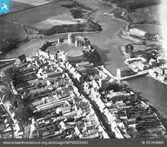
WPW029682 WALES (1929). View of Pembroke showing castle. Oblique aerial photograph, 5"x4" BW glass plate.
© Copyright OpenStreetMap contributors and licensed by the OpenStreetMap Foundation. 2026. Cartography is licensed as CC BY-SA.
Nearby Images (8)
WAW005912

 0°
0m
0°
0m
WAW005913
 0°
0m
0°
0m
WAW005914
 0°
0m
0°
0m
WAW005915
 0°
0m
0°
0m
WAW033603
 0°
0m
0°
0m
WAW033604
 0°
0m
0°
0m
WAW033605
 0°
0m
0°
0m
WPW029682
 0°
0m
0°
0m
Details
| Title | [WPW029682] View of Pembroke showing castle. Oblique aerial photograph, 5"x4" BW glass plate. |
| Reference | WPW029682 |
| Date | 1929 |
| Link | Coflein Archive Item 6422616 |
| Place name | |
| Parish | |
| District | |
| Country | WALES |
| Easting / Northing | 198595, 201400 |
| Longitude / Latitude | -4.9132777112723, 51.67473997708 |
| National Grid Reference | SM986014 |
Pins
Be the first to add a comment to this image!