
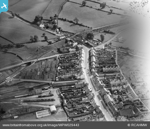
WPW029443 WALES. General view of Cowbridge, oblique aerial view. 5"x4" black and white glass plate negative.
© Copyright OpenStreetMap contributors and licensed by the OpenStreetMap Foundation. 2026. Cartography is licensed as CC BY-SA.
Nearby Images (8)
WPW008627

WPW008628

WPW012006

WPW029439

WPW029440

WPW029441

WPW029442

WPW029443

Details
| Title | [WPW029443] General view of Cowbridge, oblique aerial view. 5"x4" black and white glass plate negative. |
| Reference | WPW029443 |
| Date | |
| Link | Coflein Archive Item 6378012 |
| Place name | |
| Parish | |
| District | |
| Country | WALES |
| Easting / Northing | 299492, 174656 |
| Longitude / Latitude | -3.4469293311772, 51.461455452717 |
| National Grid Reference | SS995747 |
Pins

gBr |
Sunday 4th of June 2017 04:15:17 PM | |

Class31 |
Tuesday 17th of July 2012 08:03:50 PM | |
|
Class31 |
Tuesday 17th of July 2012 08:03:33 PM | |
|
Class31 |
Tuesday 17th of July 2012 08:03:18 PM | |
|
Chelsea61 |
Friday 29th of June 2012 12:45:54 AM |
User Comment Contributions
See also WPW029440 & WPW029442. |
BigglesH |
Wednesday 8th of August 2012 02:45:35 AM |
View of the East side of Cowbridge looking East along Eastgate towards Cardiff Road. The railway station is on the left. View taken from Map Reference SS 99626 74689. Everything fits. |
Class31 |
Tuesday 17th of July 2012 05:53:46 PM |