
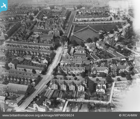
WPW008624 WALES (1923). View of Penarth showing St Josephs church and bowling green, oblique aerial view. 5"x4" black and white glass plate negative.
© Copyright OpenStreetMap contributors and licensed by the OpenStreetMap Foundation. 2026. Cartography is licensed as CC BY-SA.
Nearby Images (21)
WPW006086

WPW006088

WPW008619

WPW008621

WPW008622

WPW008623

WPW008624

WPW008625

WPW029374

WPW029375

WPW029376

WPW029378

WPW029379

WPW029380

WPW029381

WPW029382

WPW029383

WPW029385

WPW029386

WPW029388

WPW029389

Details
| Title | [WPW008624] View of Penarth showing St Josephs church and bowling green, oblique aerial view. 5"x4" black and white glass plate negative. |
| Reference | WPW008624 |
| Date | 1923 |
| Link | Coflein Archive Item 6370371 |
| Place name | |
| Parish | |
| District | |
| Country | WALES |
| Easting / Northing | 318000, 171000 |
| Longitude / Latitude | -3.1797053949986, 51.431570326534 |
| National Grid Reference | ST180710 |
Pins
 |

Class31 |
Saturday 26th of September 2015 07:32:25 PM |

Brannkouk |
Saturday 23rd of March 2013 04:28:28 PM | |
|
Brannkouk |
Saturday 23rd of March 2013 04:27:29 PM | |
|
Brannkouk |
Saturday 23rd of March 2013 04:26:36 PM |
User Comment Contributions
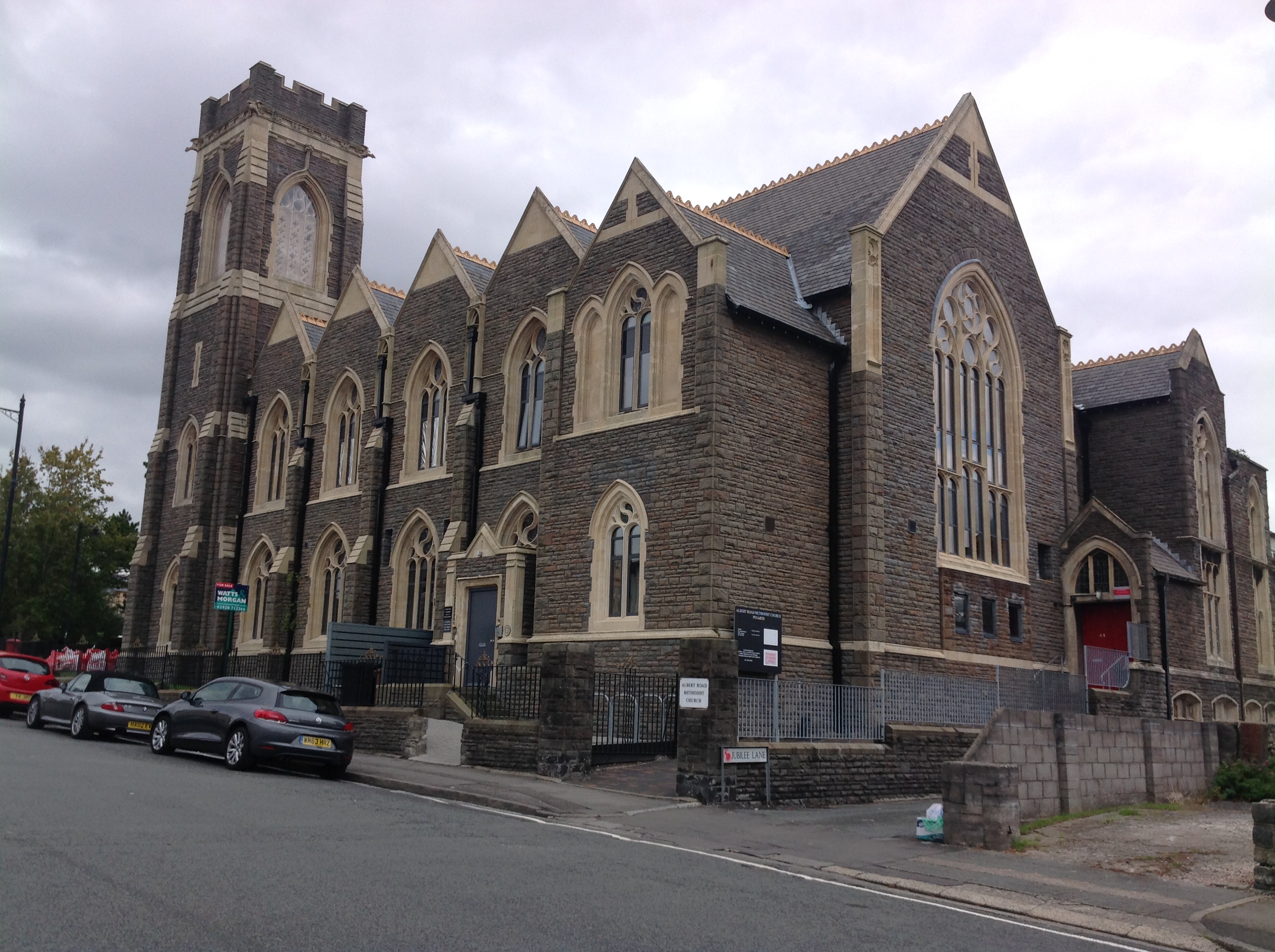
Albert Road Methodist Church, Penarth, 20/09/2015 |
Class31 |
Saturday 26th of September 2015 07:31:23 PM |
The church in the picture is Albert Rd Methodist church and not St Josephs church. |
magnoliaman |
Wednesday 26th of September 2012 07:22:47 PM |