
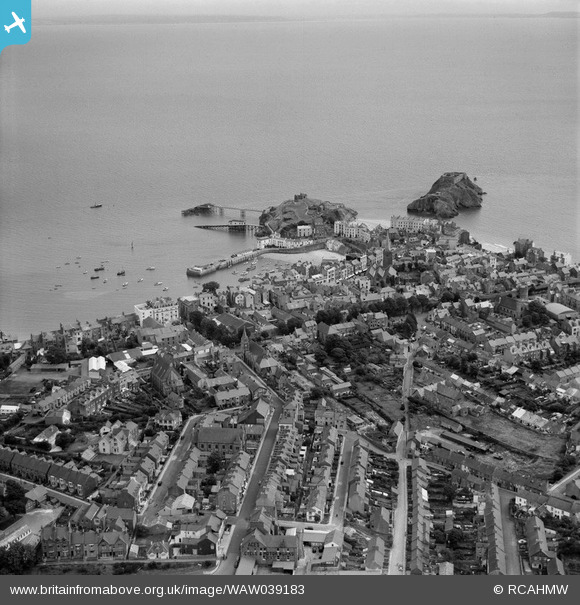
WAW039183 WALES (1951). View of Tenby showing town, including Ace's cycle and motor shop
© Copyright OpenStreetMap contributors and licensed by the OpenStreetMap Foundation. 2026. Cartography is licensed as CC BY-SA.
Nearby Images (33)
WAW033700

WAW033701

WAW033702

WAW039181

WAW039182

WAW039183

WAW039184

WAW039185

WAW039186

WAW039187

WAW039188

WAW039189

WPW006971

WPW006972

WPW006973

WPW006974

WPW029669

WPW029697

WPW029699

WPW029701

WPW029702

WPW029709

WPW055513

WPW055514

WPW055515

WPW055516

WPW055517

WPW055518

WPW055519

WAW039190

WAW039191

WAW039192

WAW039193

Details
| Title | [WAW039183] View of Tenby showing town, including Ace's cycle and motor shop |
| Reference | WAW039183 |
| Date | 1951 |
| Link | Coflein Archive Item 6414493 |
| Place name | |
| Parish | |
| District | |
| Country | WALES |
| Easting / Northing | 213466, 200437 |
| Longitude / Latitude | -4.6979249577763, 51.671225629838 |
| National Grid Reference | SN135004 |
Pins

redmist |
Wednesday 12th of May 2021 09:46:27 AM | |
 |
totoro |
Tuesday 14th of October 2014 08:05:34 PM |
 |
totoro |
Tuesday 14th of October 2014 07:49:19 PM |

Dylan Moore |
Saturday 26th of April 2014 09:35:32 PM |