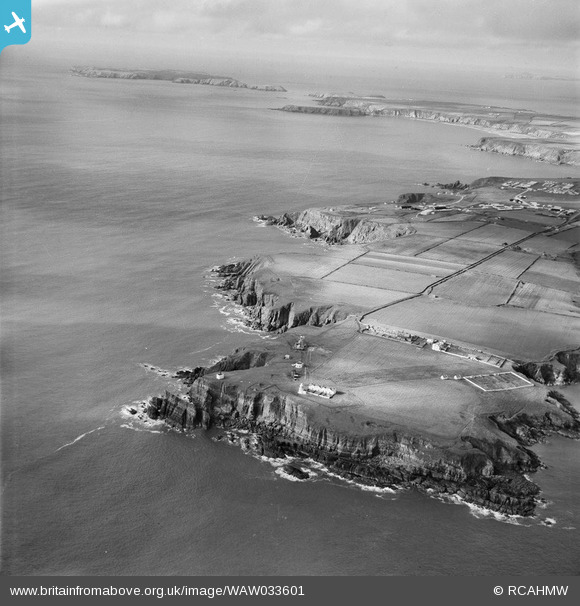
WAW033601 WALES (1950). View of St Ann's Head showing lighthouse complex
© Copyright OpenStreetMap contributors and licensed by the OpenStreetMap Foundation. 2026. Cartography is licensed as CC BY-SA.
Details
| Title | [WAW033601] View of St Ann's Head showing lighthouse complex |
| Reference | WAW033601 |
| Date | 1950 |
| Link | Coflein Archive Item 6414354 |
| Place name | |
| Parish | |
| District | |
| Country | WALES |
| Easting / Northing | 180690, 202820 |
| Longitude / Latitude | -5.1727509485516, 51.680785401576 |
| National Grid Reference | SM807028 |
Pins

DKH |
Thursday 23rd of February 2023 05:26:11 PM | |

DKH |
Thursday 23rd of February 2023 05:23:13 PM | |

redmist |
Monday 10th of May 2021 02:08:45 PM |


![[WAW033601] View of St Ann's Head showing lighthouse complex](http://britainfromabove.org.uk/sites/all/libraries/aerofilms-images/public/100x100/WAW/033/WAW033601.jpg)
![[WAW033602] View of St Ann's Head showing lighthouse complex](http://britainfromabove.org.uk/sites/all/libraries/aerofilms-images/public/100x100/WAW/033/WAW033602.jpg)