
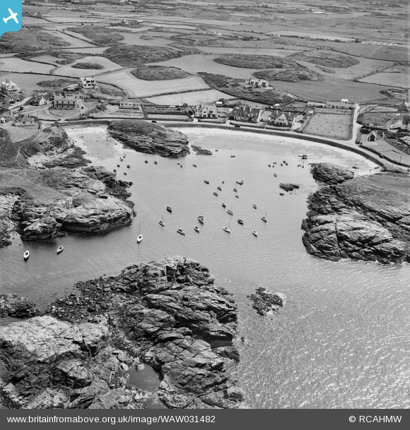
WAW031482 WALES (1950). View of Trearddur village
© Copyright OpenStreetMap contributors and licensed by the OpenStreetMap Foundation. 2024. Cartography is licensed as CC BY-SA.
Nearby Images (6)
WAW031480

WAW031481

WAW031482

WPW009472

WPW009476

WPW009481

Details
| Title | [WAW031482] View of Trearddur village |
| Reference | WAW031482 |
| Date | 1950 |
| Link | Coflein Archive Item 6414275 |
| Place name | |
| Parish | |
| District | |
| Country | WALES |
| Easting / Northing | 224600, 379500 |
| Longitude / Latitude | -4.6313644124019, 53.28313182401 |
| National Grid Reference | SH246795 |
Pins
 AndreaQ |
Wednesday 21st of August 2019 01:31:18 AM |