
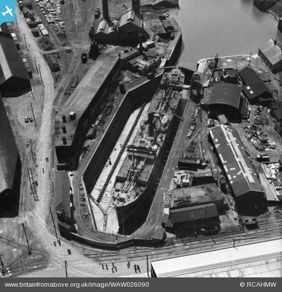
WAW026090 WALES (1949). View of Prince of Wales dry dock, Swansea, showing the ship 'Pendeen' in dry dock. Oblique aerial photograph, 5½" cut roll film.
© Copyright OpenStreetMap contributors and licensed by the OpenStreetMap Foundation. 2026. Cartography is licensed as CC BY-SA.
Nearby Images (24)
WAW026083

WAW026084

WAW026085

WAW026086

WAW026087

WAW026088

WAW026089

WAW026090

WAW026091

WAW026092

WAW026093

WAW026094

WAW026095

WAW026096

WAW026097

WAW026098

WAW026099

WAW026100

WAW026101

WAW026102

WAW026103

WAW026104

WAW026105

WAW026106

Details
| Title | [WAW026090] View of Prince of Wales dry dock, Swansea, showing the ship 'Pendeen' in dry dock. Oblique aerial photograph, 5½" cut roll film. |
| Reference | WAW026090 |
| Date | 12-August-1949 |
| Link | Coflein Archive Item 6423448 |
| Place name | |
| Parish | |
| District | |
| Country | WALES |
| Easting / Northing | 266822, 192697 |
| Longitude / Latitude | -3.9238294072886, 51.616852415573 |
| National Grid Reference | SS668927 |
Pins

Class31 |
Tuesday 6th of January 2015 11:03:12 AM |