
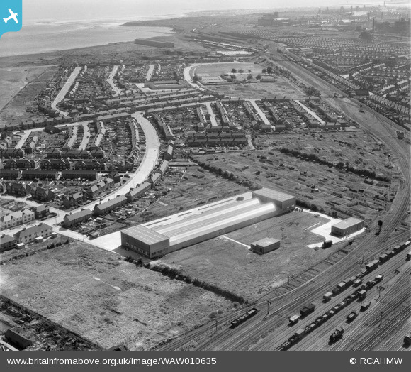
WAW010635 WALES (1947). View of F.E. Fox biscuit factory, Cardiff showing Splott Park and Tremorfa
© Copyright OpenStreetMap contributors and licensed by the OpenStreetMap Foundation. 2026. Cartography is licensed as CC BY-SA.
Nearby Images (9)
WAW010631

WAW010632

WAW010633

WAW010634

WAW010635

WAW010636

WAW010637

WAW010638

WAW010639

Details
| Title | [WAW010635] View of F.E. Fox biscuit factory, Cardiff showing Splott Park and Tremorfa |
| Reference | WAW010635 |
| Date | 1-September-1947 |
| Link | Coflein Archive Item 6413732 |
| Place name | |
| Parish | |
| District | |
| Country | WALES |
| Easting / Northing | 320680, 177500 |
| Longitude / Latitude | -3.1426161042471, 51.490392001192 |
| National Grid Reference | ST207775 |
Pins

redmist |
Monday 23rd of November 2020 05:12:37 PM | |
|
redmist |
Monday 23rd of November 2020 05:09:23 PM | |
|
redmist |
Monday 23rd of November 2020 05:06:45 PM | |
|
redmist |
Monday 23rd of November 2020 05:05:29 PM | |
|
redmist |
Monday 23rd of November 2020 04:58:48 PM | |

Class31 |
Tuesday 29th of July 2014 05:15:24 PM | |
|
Class31 |
Tuesday 29th of July 2014 05:14:58 PM |
User Comment Contributions
This structure appears to still be here, albeit somewhat extended. http://binged.it/1gBVEud |
hjr |
Thursday 29th of May 2014 01:46:47 AM |