
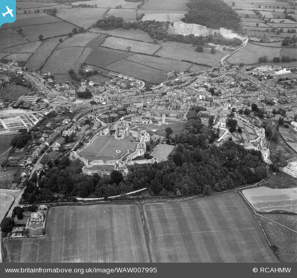
WAW007995 WALES (1947). View of Denbigh showing castle
© Copyright OpenStreetMap contributors and licensed by the OpenStreetMap Foundation. 2026. Cartography is licensed as CC BY-SA.
Nearby Images (4)
WAW007995

WAW007999

WAW008001

WAW008002

Details
| Title | [WAW007995] View of Denbigh showing castle |
| Reference | WAW007995 |
| Date | 30-June-1947 |
| Link | Coflein Archive Item 6413559 |
| Place name | |
| Parish | |
| District | |
| Country | WALES |
| Easting / Northing | 305260, 366110 |
| Longitude / Latitude | -3.4178948504298, 53.183353682004 |
| National Grid Reference | SJ053661 |
Pins
Be the first to add a comment to this image!