
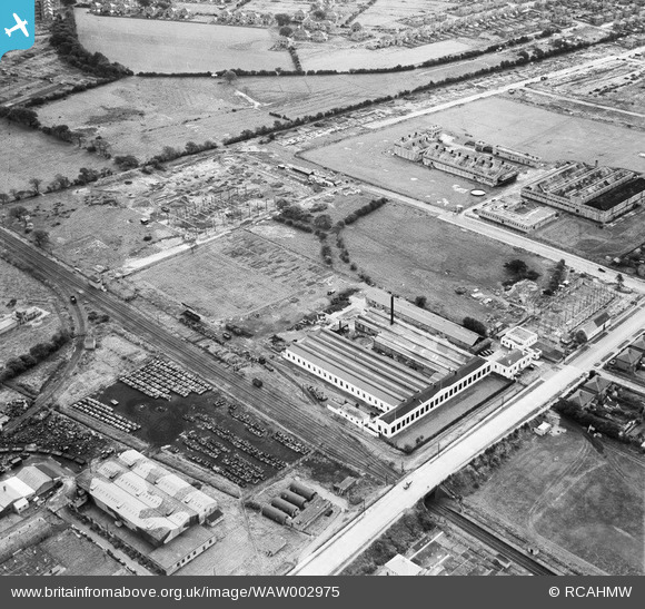
WAW002975 WALES (1946). View of Morgan Rees & Sons Ltd. Whitchurch, showing redundant military armoured vehicles stored at the adjacent Royal Odnance Factory
© Copyright OpenStreetMap contributors and licensed by the OpenStreetMap Foundation. 2026. Cartography is licensed as CC BY-SA.
Nearby Images (22)
WAW002973

WAW002974

WAW002975

WAW002976

WAW002977

WAW002978

WAW002979

WPW048362

WPW048363

WPW048364

WPW048365

WPW048366

WPW048367

WPW048368

WPW054723

WPW058523

WPW058524

WPW058525

WPW058526

WPW058527

WPW058528

WPW058529

Details
| Title | [WAW002975] View of Morgan Rees & Sons Ltd. Whitchurch, showing redundant military armoured vehicles stored at the adjacent Royal Odnance Factory |
| Reference | WAW002975 |
| Date | 3-October-1946 |
| Link | Coflein Archive Item 6413241 |
| Place name | |
| Parish | |
| District | |
| Country | WALES |
| Easting / Northing | 316785, 180925 |
| Longitude / Latitude | -3.1995195889358, 51.520624603707 |
| National Grid Reference | ST168809 |
Pins

redmist |
Monday 10th of May 2021 10:03:55 AM | |
|
redmist |
Monday 10th of May 2021 10:03:34 AM | |
|
redmist |
Monday 10th of May 2021 10:02:50 AM | |
|
redmist |
Monday 10th of May 2021 10:02:24 AM | |
|
redmist |
Monday 10th of May 2021 10:01:53 AM | |
|
redmist |
Monday 10th of May 2021 10:01:19 AM | |
|
MB |
Saturday 26th of April 2014 04:32:24 PM |