
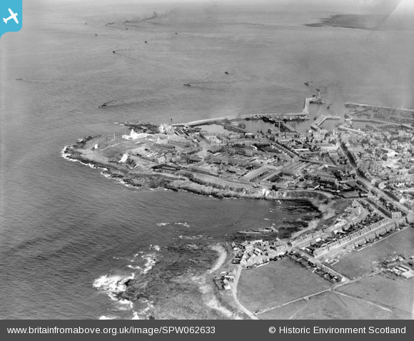
SPW062633 SCOTLAND (1939). Fraserburgh, general view, showing Fraserburgh Harbour and Kinnaird Head. An oblique aerial photograph taken facing east.
© Copyright OpenStreetMap contributors and licensed by the OpenStreetMap Foundation. 2026. Cartography is licensed as CC BY-SA.
Nearby Images (5)
SPW062633

SPW062635

SAR036706

SPW062629

SPW062632

Details
| Title | [SPW062633] Fraserburgh, general view, showing Fraserburgh Harbour and Kinnaird Head. An oblique aerial photograph taken facing east. |
| Reference | SPW062633 |
| Date | 1939 |
| Link | NRHE Collection item 1258309 |
| Place name | |
| Parish | FRASERBURGH |
| District | BANFF AND BUCHAN |
| Country | SCOTLAND |
| Easting / Northing | 399800, 867400 |
| Longitude / Latitude | -2.0033555687435, 57.696673398149 |
| National Grid Reference | NJ998674 |
Pins
Be the first to add a comment to this image!