
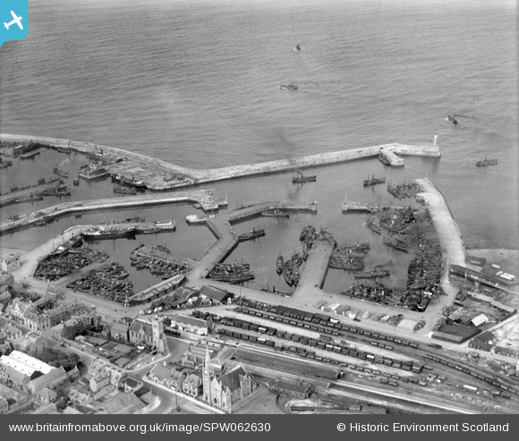
SPW062630 SCOTLAND (1939). Fraserburgh Harbour. An oblique aerial photograph taken facing north-east.
© Copyright OpenStreetMap contributors and licensed by the OpenStreetMap Foundation. 2026. Cartography is licensed as CC BY-SA.
Nearby Images (3)
SPW062630

SPW062631

SPW062628

Details
| Title | [SPW062630] Fraserburgh Harbour. An oblique aerial photograph taken facing north-east. |
| Reference | SPW062630 |
| Date | 1939 |
| Link | NRHE Collection item 1258306 |
| Place name | |
| Parish | FRASERBURGH |
| District | BANFF AND BUCHAN |
| Country | SCOTLAND |
| Easting / Northing | 400159, 866859 |
| Longitude / Latitude | -1.9973326799971, 57.691813448019 |
| National Grid Reference | NK002669 |
Pins
Be the first to add a comment to this image!