
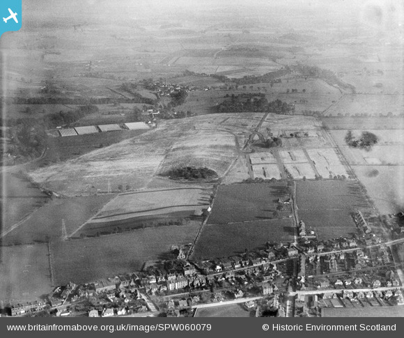
SPW060079 SCOTLAND (1938). Kirkton Housing Estate, Dundee, under construction. An oblique aerial photograph taken facing east.
© Copyright OpenStreetMap contributors and licensed by the OpenStreetMap Foundation. 2026. Cartography is licensed as CC BY-SA.
Nearby Images (2)
SPW060078

SPW060079

Details
| Title | [SPW060079] Kirkton Housing Estate, Dundee, under construction. An oblique aerial photograph taken facing east. |
| Reference | SPW060079 |
| Date | 1938 |
| Link | NRHE Collection item 1259541 |
| Place name | |
| Parish | DUNDEE (DUNDEE, CITY OF) |
| District | CITY OF DUNDEE |
| Country | SCOTLAND |
| Easting / Northing | 339711, 733693 |
| Longitude / Latitude | -2.9792463408075, 56.491568497409 |
| National Grid Reference | NO397337 |
Pins


User Comment Contributions
This is a 2012 picture of houses opposite Doc Stuarts in Downfield. You can just see the 3 windows of the building on the bottom left hand side of the aerial photo. |

Brian |
Wednesday 28th of November 2012 01:16:40 PM |