
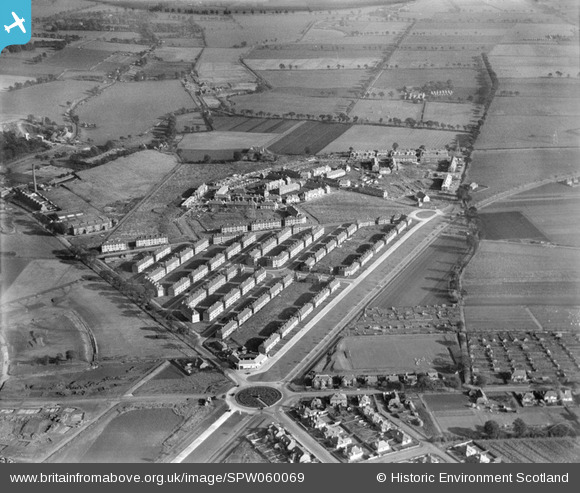
SPW060069 SCOTLAND (1938). Mid Craigie Housing Estate, Dundee. An oblique aerial photograph taken facing east.
© Copyright OpenStreetMap contributors and licensed by the OpenStreetMap Foundation. 2026. Cartography is licensed as CC BY-SA.
Nearby Images (4)
SPW060069

SPW060070

SPW060071

SAR036853

Details
| Title | [SPW060069] Mid Craigie Housing Estate, Dundee. An oblique aerial photograph taken facing east. |
| Reference | SPW060069 |
| Date | 1938 |
| Link | NRHE Collection item 1259531 |
| Place name | |
| Parish | DUNDEE (DUNDEE, CITY OF) |
| District | CITY OF DUNDEE |
| Country | SCOTLAND |
| Easting / Northing | 342450, 732390 |
| Longitude / Latitude | -2.934477105737, 56.480205276609 |
| National Grid Reference | NO425324 |
Pins

robw0910 |
Tuesday 7th of July 2015 03:32:25 AM | |
|
craig e king |
Tuesday 3rd of July 2012 11:07:14 PM | |
|
geeziz |
Tuesday 26th of June 2012 03:54:29 AM | |
|
geeziz |
Tuesday 26th of June 2012 03:53:51 AM | |
was factorys before that? something to do with timex? |
peh in the skeh |
Friday 10th of July 2015 11:55:11 PM |
User Comment Contributions
eh kin see meh hoose fae here! 21 pitairlie road. best years o meh life bar none 1967---1983 |
peh in the skeh |
Friday 10th of July 2015 11:51:31 PM |