
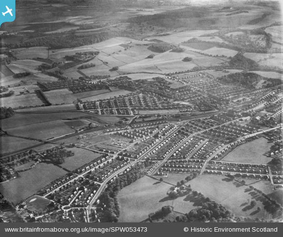
SPW053473 SCOTLAND (1937). General view, Burnside, Rutherglen, Lanarkshire, Scotland, 1937. An oblique aerial photograph, taken facing south-west.
© Copyright OpenStreetMap contributors and licensed by the OpenStreetMap Foundation. 2026. Cartography is licensed as CC BY-SA.
Nearby Images (2)
SPW053473

SPW053472

Details
| Title | [SPW053473] General view, Burnside, Rutherglen, Lanarkshire, Scotland, 1937. An oblique aerial photograph, taken facing south-west. |
| Reference | SPW053473 |
| Date | 1937 |
| Link | NRHE Collection item 1452107 |
| Place name | |
| Parish | CAMBUSLANG (CITY OF GLASGOW) |
| District | CITY OF GLASGOW |
| Country | SCOTLAND |
| Easting / Northing | 262254, 660054 |
| Longitude / Latitude | -4.1984791073416, 55.814096415099 |
| National Grid Reference | NS623601 |
Pins
Be the first to add a comment to this image!