
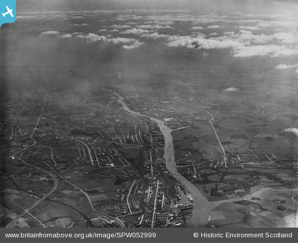
SPW052999 SCOTLAND (1937). Glasgow, general view, showing Clydebank and Prince's Dock. An oblique aerial photograph taken facing south-east. This image has been produced from a print.
© Copyright OpenStreetMap contributors and licensed by the OpenStreetMap Foundation. 2025. Cartography is licensed as CC BY-SA.
Nearby Images (2)
SPW052999

SPW019465

Details
| Title | [SPW052999] Glasgow, general view, showing Clydebank and Prince's Dock. An oblique aerial photograph taken facing south-east. This image has been produced from a print. |
| Reference | SPW052999 |
| Date | 1937 |
| Link | Canmore Collection item 1315600 |
| Place name | |
| Parish | GLASGOW (CITY OF GLASGOW) |
| District | CITY OF GLASGOW |
| Country | SCOTLAND |
| Easting / Northing | 252150, 668110 |
| Longitude / Latitude | -4.363982618311, 55.883439185549 |
| National Grid Reference | NS522681 |
Pins
Be the first to add a comment to this image!