
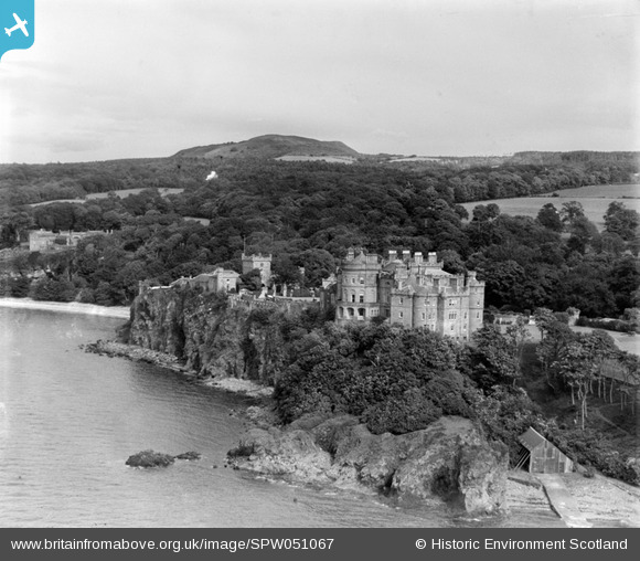
SPW051067 SCOTLAND (1936). Culzean Castle, Maybole. An oblique aerial photograph taken facing east.
© Copyright OpenStreetMap contributors and licensed by the OpenStreetMap Foundation. 2026. Cartography is licensed as CC BY-SA.
Nearby Images (2)
SPW051067

SAR019236

Details
| Title | [SPW051067] Culzean Castle, Maybole. An oblique aerial photograph taken facing east. |
| Reference | SPW051067 |
| Date | 1936 |
| Link | NRHE Collection item 1258090 |
| Place name | |
| Parish | KIRKOSWALD |
| District | KYLE AND CARRICK |
| Country | SCOTLAND |
| Easting / Northing | 223315, 610316 |
| Longitude / Latitude | -4.7873774086336, 55.354998302168 |
| National Grid Reference | NS233103 |
Pins

Alan McFarlane |
Sunday 30th of June 2013 11:27:41 AM | |
|
Alan McFarlane |
Friday 17th of May 2013 03:51:03 PM | |
|
Alan McFarlane |
Friday 17th of May 2013 03:49:16 PM | |
|
Alan McFarlane |
Friday 17th of May 2013 03:48:13 PM | |
|
zoom2 |
Monday 16th of July 2012 09:12:48 PM | |
|
Alan McFarlane |
Thursday 14th of June 2012 08:14:51 PM |
User Comment Contributions

The very picturesque castle on the Ayrshire coast. |
Alan McFarlane |
Thursday 14th of June 2012 09:21:14 AM |